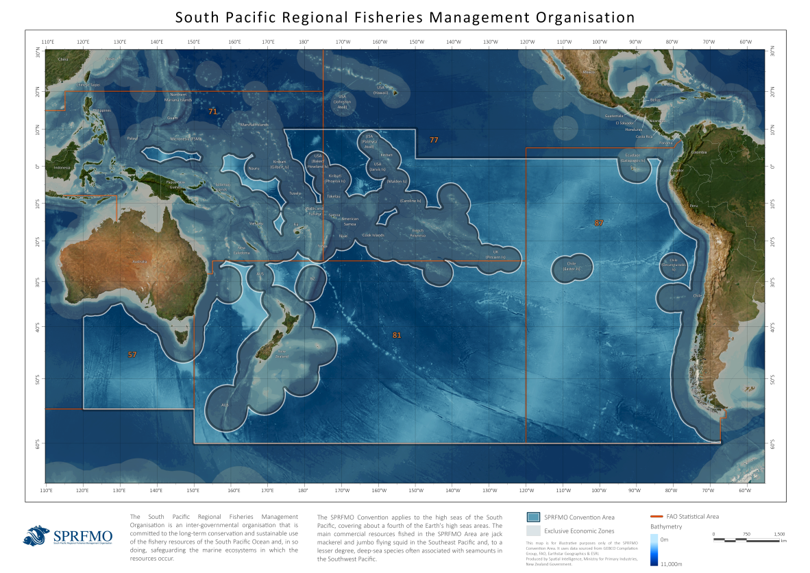
Home > About SPRFMO » Illustrative Map of the SPRFMO Area
The SPRFMO Secretariat has made the above map available for information purposes only. It is a pictorial illustration of the area of application of the Convention that is properly described in legal terms in Article 5. The map is not part of the Convention text and has no legal status. It is not intended to reflect exactly the maritime spaces of adjoining coastal states and cannot be considered to constitute recognition of the claims or positions of any of the participants in the negotiations leading to the adoption of the Convention concerning the legal status and extent of waters and zones claimed by such participants.
Shape files for the SPRFMO Area are held by FAO GeoNetwork. GeoNetwork opensource allows to easily share geographically referenced thematic information between different organizations. For more information please contact GeoNetwork@fao.org.